
North Bay & Sierra Briefing
American Canyon Sets Watson Ranch Hearing as Coastal Swells Build
American Canyon's City Council will hold a Nov. 17 hearing at 6:30 p.m. on street and 12-inch waterline revisions for the 216-lot Promontory subdivision in the 309-acre Watson Ranch project, while forecasters track a pre-Thanksgiving Sierra snow pattern and the National Weather Service warns of 12-to-16-foot Bay Area waves and 1.6-foot tidal flooding through Nov. 13.
Your listening Queue & catch up
Add a story or build a catch-up queue to start listening.
Municipal planners in southern Napa County are preparing to review infrastructure revisions for a major hillside housing development in American Canyon, even as meteorologists track hazardous 12-to-16-foot surf along the Northern California coast and a mid-November storm pattern aimed at the Sierra Nevada.
American Canyon Schedules Nov. 17 Council Hearing on 216-Lot Watson Ranch Subdivision
The American Canyon City Council will hold a public hearing on Tuesday, Nov. 17, at 6:30 p.m. at City Hall, 4381 Broadway, Suite 201, to consider roadway, trail, and utility alignment amendments for the 216-lot Promontory subdivision within the 309-acre Watson Ranch master-planned community.
Originally approved by the city in July and August 2023 and recommended unanimously by the American Canyon Planning Commission on Oct. 22, the requested conditions-of-approval updates submitted by master developer 330 Land Company include:
- Newell Drive Alignment: Releasing 330 Land Company from the obligation to construct a full northern extension of Newell Drive all the way to Rio del Mar, while requiring the developer to build a segment of Newell Drive terminating within 150 feet of the northern property boundary.
- Waterline Relocation: Shifting a planned 12-inch municipal water transmission main from the steep hillside alignment into the graded right-of-way along B Street, alongside updated multi-use trail connections.
National Weather Service Issues Beach Hazard Statement for 12-to-16-Foot Waves
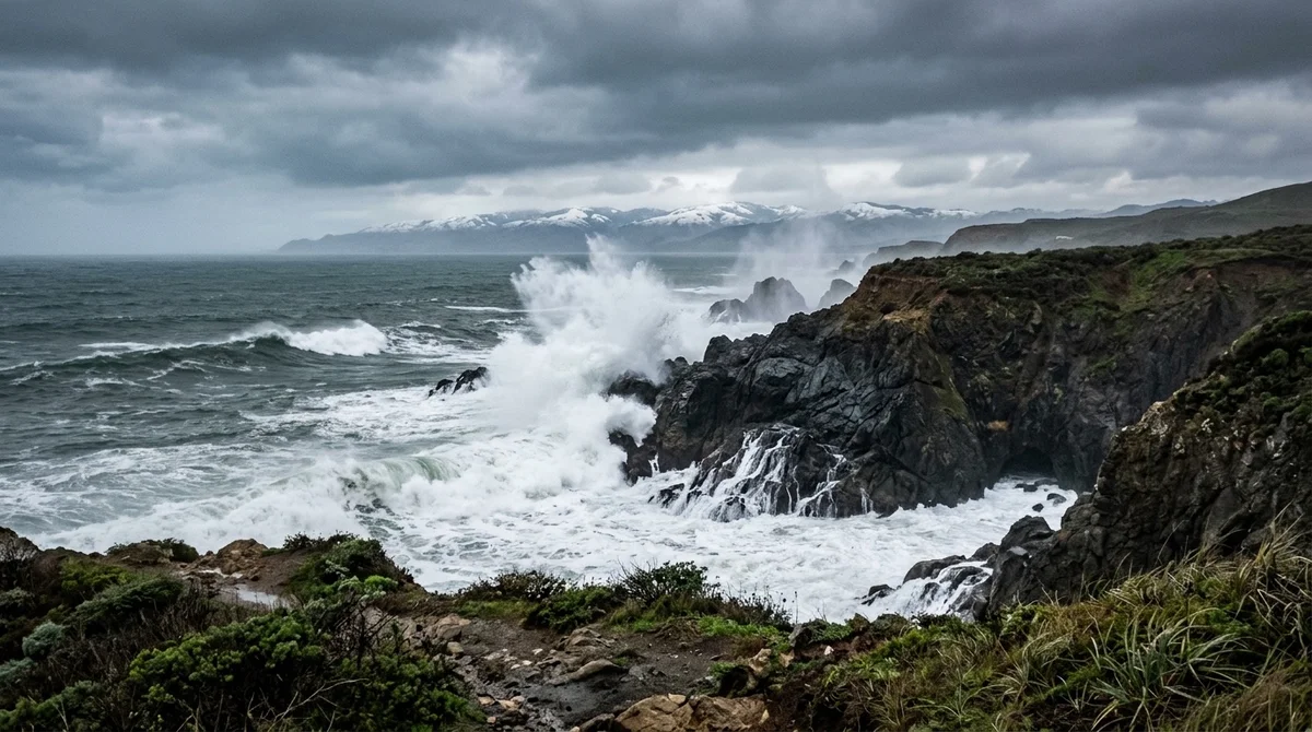
Along the Pacific coastline from Sonoma and Marin counties down through San Francisco and San Mateo counties, the National Weather Service issued a beach hazard statement through Monday and a coastal flood advisory through Nov. 13.
Forecasters warn that long-period northwest swells will generate breaking waves of 12 to 16 feet at west- and northwest-facing beaches, creating dangerous sneaker waves and rip currents ahead of next weekend's Mavericks big-wave surfing competition window off Half Moon Bay. Simultaneously, astronomical tides running 1.6 feet above normal are expected to produce up to 1.6 feet of saltwater inundation across low-lying bayside roadways and pathways through Nov. 13—a prelude to the season's highest "king tides" scheduled for Nov. 24 to Nov. 26. U.S. Geological Survey research oceanographer Sean Vitousek noted that regional sea-level anomalies are currently running roughly 1 foot above historical baselines, amplifying shallow tidal overflow events.
Forecasters Track Pre-Thanksgiving Atmospheric River Aimed at Lake Tahoe
Further inland, ski resorts around Lake Tahoe are watching medium-range ensemble models that point toward a wintry pattern reversal later this month. According to meteorologists and Tahoe ski industry analyst Kevin Cooper, a brief ridge of high pressure will bring mild, dry conditions across Northern California this weekend before the Pacific jet stream shifts southward in mid-November, opening the door for an atmospheric river series capable of blanketing high-elevation Sierra Nevada slopes with several feet of snow ahead of the Thanksgiving holiday weekend.
Sources
Comments (0)
No comments yet. Be the first to share a thought on this story.
Nominate a neighbor or local businessRequest a correctionContact the newsroom